I am proud to announce that Open North is launching a new project, Open511, funded by GeoConnections, a federal program dedicated to geospatial data infrastructure. Open511’s goal is to develop an open data standard and API to help governments publish road event data (such as accidents, road closures, etc.). We believe the project will have a great impact in local communities across Canada, and we hope it will foster an ecosystem around road event data, much as GTFS has fostered one around public transit data.
Open511’s origin story
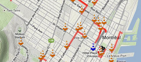
It all started with ZoneCone.ca, a webapp I developed that aggregates road closure data from the Transports Quebec and the City of Montreal.
I soon realized that many different organizations work on our roads: municipalities, the province, the federal government (bridges), private infrastructure contractors (Highway 30, Highway 25 bridge) and all the utilities you can think of (Hydro-Québec, Gaz Métro, Bell, etc.). Some of these bodies publish data, others don’t. When they do, the data provide insufficient detail and each organization uses a different format. In short, painting a global picture of current road obstructions is impractical.
Open511’s goal is to solve this problem.
At the start line
Open511 is about simply and sustainably making road event data available and accessible, following an open data philosophy. The core components of Open511 are: a standard, an API and a lightweight open source webapp to manage and publish road event data. This last tool is for jurisdictions that don’t have the capacity to develop their own software. Open511 has three main benefits:
-
By making relevant data available in a single, common and detailed format, third parties can easily develop apps and integrate data into their offerings.
-
Given the various actors working on our roads, cities have a hard time coordinating road maintenance and construction. Some develop internal tools, others use commercial offerings, but all these solutions are “closed,” making it difficult for cities to share information with relevant parties. The adoption of a standard format would make sharing and collaboration much easier.
-
Although governments are working hard to improve their data’s precision and coverage – such as by installing traffic cameras – there is still much work to do, especially in cities. By carefully adopting crowdsourcing, governments can use reports sent by people on the road to improve their data quality.
The project takes many lessons from the development of Open311, a successful project by OpenPlans to create a common and ready-to-use data format for 311 services. Open511 faces some new challenges, like how to support multiple organizations having jurisdiction over the same geographical territory. And whereas Open311 focuses on data from citizens, Open511 mixes authoritative data from governments with data requiring verification from citizens.
The road ahead
We are in discussions with government technicians to understand how they work and to learn more about existing solutions, needs and wishes. We can count on several high quality collaborators:
-
The Ministry of Transportation and Infrastructure of British Columbia, the City of Montreal, the City of Ottawa and the City of Repentigny will provide insights on how governments manage road event data and present their vision for the future.
-
The école Polytechnique de Montréal, Living Lab of Montreal, International Institute of Logistics of Montreal, InstantGeo and David Eaves will help elaborate, test and provide feedback on the standard.
In the coming months, expect to see a dedicated website where we will document our progress… and challenges!
We are always eager to speak with others in this field. If this project interests you, email Stéphane Guidoin, transportation director at Open North.